Identifier
MSN
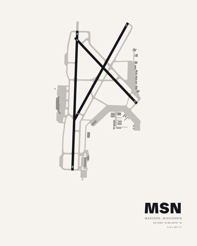
A runway diagram map print of Dane County Regional/Truax Field (MSN), made from the airport's own layout for the place it holds in your life. Choose your colorway and your format: a fine art giclée print on cotton paper, a framed fine art print, a glossy metal print or a digital download.
Your fine art print is made to order with pigment inks on heavyweight, 100% cotton Hot Press paper, a 330 gsm sheet with a high color gamut and deep black density. The acid-free, archival-grade paper has a smooth matte surface. Supplied unframed, ready for your own frame.
Choosing a gift? Read our gift guide for pilots.
Physical prints are made to order in 2 to 3 business days; shipping time is added on top and varies by your location and the method you choose. Standard shipping is free across the US. Orders containing only paper prints ship flat, though paper may retain a slight curl; orders with framed or metal pieces ship in separate boxes. Digital downloads are delivered by email, so there is nothing to ship.
The Digital Download is a JPEG at 300 dpi, sized for 24 by 30 inches. The digital add-on matches the selected physical print size at 300 dpi. Download links arrive by email and stay active for 30 days; save the file within that time and keep it for personal, non-commercial use. No physical item is shipped.
Physical products have a 30-day money-back guarantee. Contact us within 30 days of delivery to request a refund; we may require a return before issuing it.
Digital downloads are non-refundable once delivered, except where required by law or where AirportPrints determines that a delivery failure or technical issue was caused by AirportPrints.
Fine Art Print: pigment giclée printing on heavyweight 330 gsm (17 mil), 100% cotton Hot Press paper, on regularly calibrated giclée printers. The paper is acid-free and archival-grade, with a smooth matte surface and the high color gamut and black density that let a dark ground and fine linework keep their depth. Supplied unframed, with no added white margin, ready for your own frame.
Framed Fine Art Print: the same cotton fine art paper in a 1.25 inch solid wood frame. A white, acid-free, 4-ply mat with a 45-degree bevel and optical-grade, shatter-resistant clear acrylic (safer to ship than glass) are included. The print is mounted to foam core for a flat presentation, with a kraft paper dust cover and installed hanging wire on the back.
Glossy Metal Print: the image is transferred by dye sublimation into polymer-coated aluminum with a glossy white base. The 1.14 mm panel has a scratch- and water-resistant surface, with a hidden inset mount that positions it about 3/4 inch off the wall. Display indoors, away from direct sunlight.
Digital Download: a high-resolution JPEG for personal, non-commercial use. No physical paper, frame, or metal panel is included.
Fine Art Print: 8 x 10, 16 x 20, and 24 x 30 inches.
Framed Fine Art Print: 8 x 10, 16 x 20, and 24 x 30 inches, measured across the mat and acrylic area inside the frame. The mat sits within that area, so the visible image is about 6 x 8, 12 x 16, or 18 x 24 inches. The outside frame is larger than the listed size.
Glossy Metal Print: 8 x 10, 16 x 20, and 24 x 30 inches. During sublimation, 1/8 to 1/4 inch of the artwork may be cropped, so the printed edge can differ slightly from the preview.
Digital Download: a 7200 x 9000 pixel JPEG at 300 dpi for 24 x 30 inch printing. A digital add-on instead matches the selected physical size: 8 x 10, 16 x 20, or 24 x 30 inches at 300 dpi.
This is Madison's own layout, the way its runways run and the taxiways thread between them, composed into a print you will want to look at every day. Not a stock template with a new name on it.
Heavyweight 330 gsm, 100% cotton Hot Press paper, acid-free and archival-grade. Its high color gamut and black density give the runways real depth, and pigment inks keep the fine detail crisp on a smooth matte surface.
Frame it in 1.25 inch solid wood, black, white or natural oak, with the white beveled mat, optical-grade clear acrylic and hanging wire included. Or choose glossy metal: dye sublimation into aluminum, floated about 3/4 inch off the wall on a hidden mount.
Composed from published airport information and available field depictions as original wall art. Learn how AirportPrints maps take shape.
Dane County Regional/Truax Field has three concrete runways, and the print draws all three. Runway 18/36 is the long one at 9,006 by 150 feet, running nearly straight down the left side of the composition. Runway 03/21 (7,200 by 150 feet) and runway 14/32 (5,846 by 150 feet) angle across the field and cross each other east of that strip, forming a clean X. Field elevation is 887 feet, set in the corner block with the coordinates and the MSN identifier.
What makes this one work on a wall is the tension between the vertical and the two diagonals. The 14 threshold sits at the top of 18/36 and the 03 threshold near its bottom, so the three runways pinch together at both ends and open out into that crossing in the middle. Taxiways and apron are plotted in a lighter gray so the runways carry the weight, and the terminal and hangar rows stack along the right edge as a band of small rectangles. It reads as geometry first, airport second, which is why it holds up at a distance.
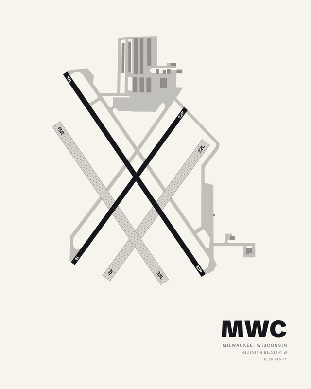
The ground under all of it was a cabbage patch for a nearby sauerkraut factory before the City of Madison bought 290 acres in 1927. It became Truax Field in 1942, activated as an Army Air Corps airfield and named for Madison native Lt. Thomas "Bud" Truax, who had died while training at the base. The airport covers 3,500 acres and sits about 6 nautical miles northeast of downtown Madison, and its 2006 terminal expansion was built in a Frank Lloyd Wright influenced prairie style. Collectors working through the region often hang this one beside nearby fields such as Janesville or Milwaukee.
Three. Runway 18/36 is 9,006 by 150 feet, runway 03/21 is 7,200 by 150 feet, and runway 14/32 is 5,846 by 150 feet. All three are concrete, and all three appear in the artwork.
Field elevation is 887 feet, printed in the corner block. The airport is in Madison, Wisconsin, roughly 6 nautical miles northeast of downtown Madison, at 43.1399 N, 89.3375 W.
MSN is the identifier for Dane County Regional/Truax Field. The print uses the three-letter form because that is the code travelers recognize on a boarding pass and the one that sets cleanly at large type.
The diagram is plotted from published airport information for this field, including runway lengths, widths and orientations. It is a designed piece rather than a navigation chart, so fine details may be simplified or omitted. Approach lighting, markings and small service structures are examples of what gets left out.
Fine Art Print, Framed Fine Art Print, Glossy Metal Print and Digital Download, in a range of sizes. Physical pieces are made to order in the colorway you choose; the digital option is a file you print yourself.
It lands well for anyone with a Madison connection: a pilot who flies the 9,006 foot runway, a university family, or someone who has watched that X of crossing runways slide past the window on approach. The layout is specific enough to be personal and quiet enough for an office wall.